<
>
1 - 4
Rotterdam
Rotterdam : is a city in South Holland, the Netherlands, located geographically within the Rhine–Meuse–Scheldt river delta at the North Sea. Its history goes back to 1270 when a dam was constructed in the Rotte river and people settled around it for safety. In 1340 Rotterdam was granted city rights by the Count of Holland and slowly grew into a major logistic and economic centre. Nowadays it is home to Europe's largest port and has a population of 624,799 (2014, city proper), ranking second in the Netherlands. The Greater Rijnmond area is home to approximately 1.4 million people and the Rotterdam The Hague urban area makes for the 168th most populous urban area in the world. Rotterdam is part of the yet larger Randstad conurbation with a total population of 7,100,000.
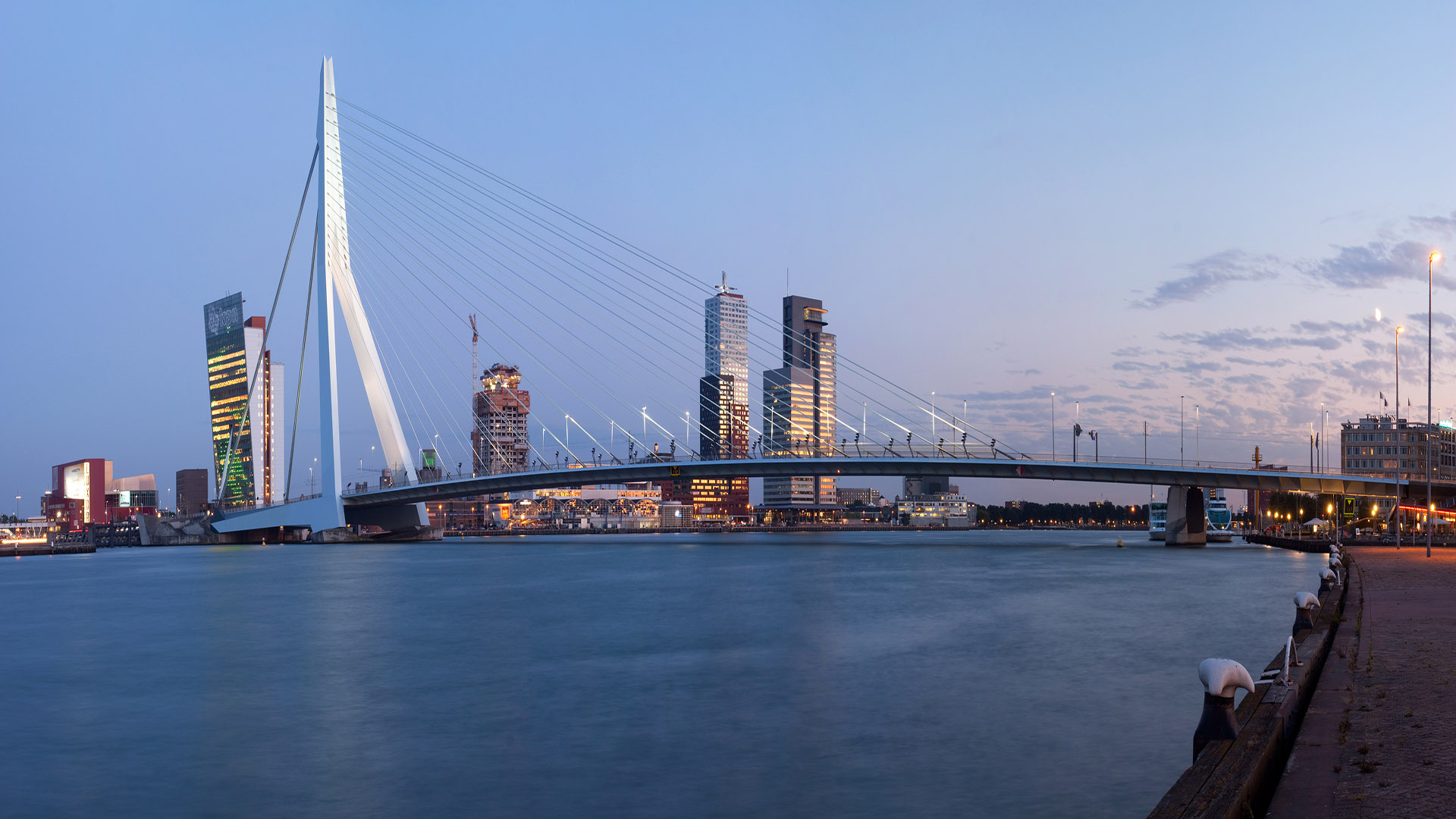
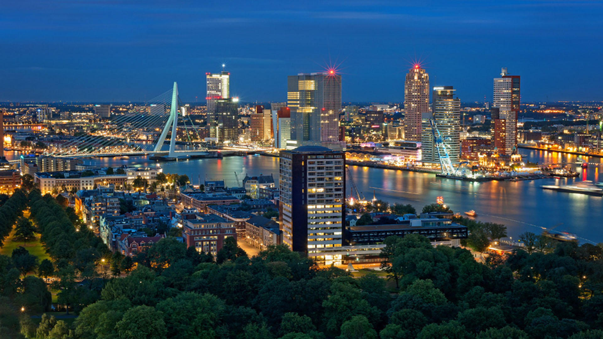
The city of Rotterdam is known for the Erasmus university, riverside setting, lively cultural life and its maritime heritage. The near-complete destruction of Rotterdam's city centre during World War II (known as the Rotterdam Blitz) has resulted in a varied architectural landscape including sky-scrapers, which are an uncommon sight in other Dutch cities. Rotterdam is home to some world-famous architecture from renowned architects like Rem Koolhaas, Piet Blom, Ben van Berkel and others. Recently Rotterdam was listed 8th in The Rough Guide Top 10 Cities to Visitand was voted 2015 European City of the Year by the Academy of Urbanism.
The port of Rotterdam is the largest cargo port in Europe and the 10th largest in the world. Rotterdam's logistic success is based on its strategic location on the North Sea, directly at the mouth of the Nieuwe Maas (New Meuse) channel leading into the Rhine–Meuse–Scheldt delta. The rivers Rhine, Meuse and Scheldt give waterway access into the heart of Western Europe, including the highly industrialized Ruhr region. The extensive distribution system including rail, roads and waterways have earned Rotterdam the nickname "Gateway to Europe", and, conversely; "Gateway to the World" in Europe.
The greatest spurt of growth, both in port activity and population, followed the completion of the Nieuwe Waterweg in 1872. The city and harbor started to expand on the south bank of the river. The Witte Huis or White House skyscraper. inspired by American office buildings and built in 1898 in the French Chateau-style, is evidence of Rotterdam's rapid growth and success. When completed, it was the tallest office building in Europe, with a height of 45 m (147.64 ft).
During World War I the city was the world's largest spy centre because of Dutch neutrality and its location in between England, Germany and occupied Belgium.
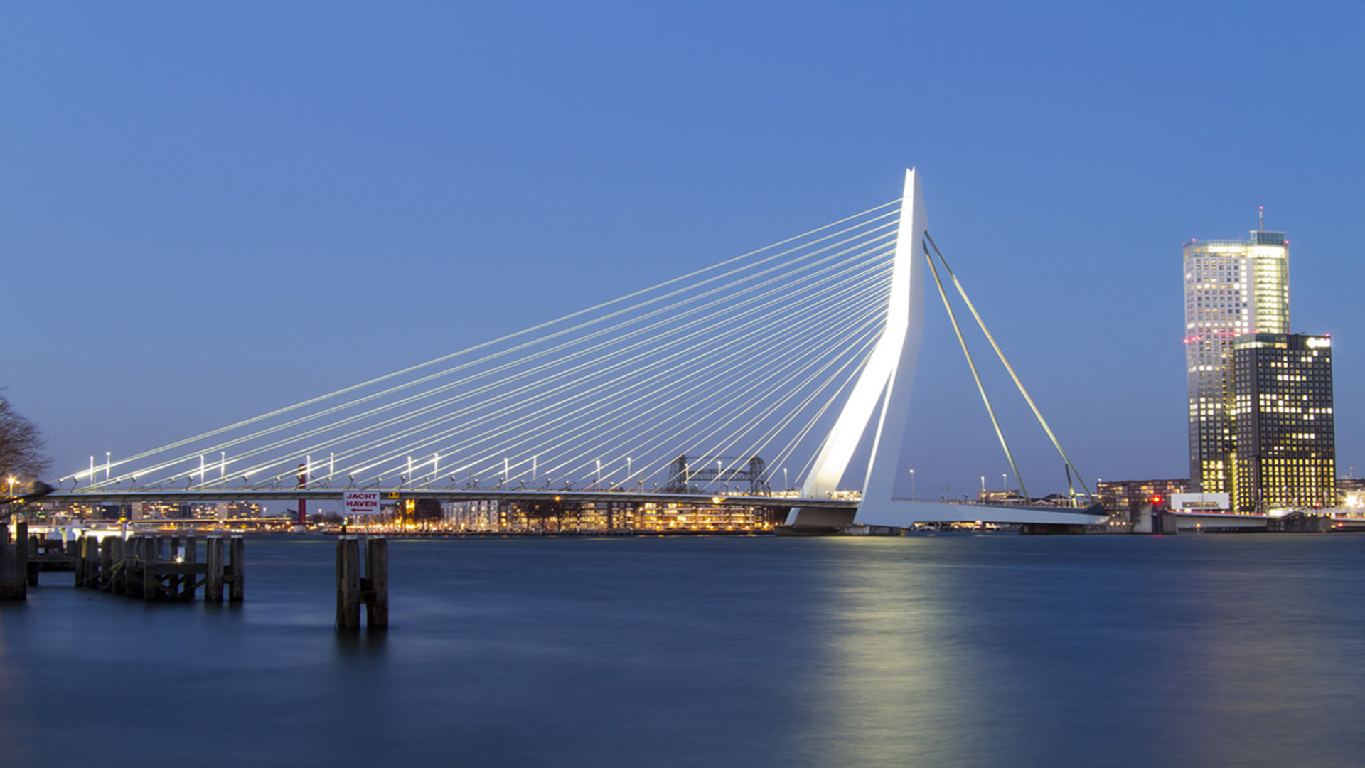
During World War II, the German army invaded the Netherlands on 10 May 1940. Adolf Hitler had hoped to conquer the country in just one day, but his forces met unexpectedly fierce resistance. The Dutch army was finally forced to capitulate on 15 May 1940, following Hitler's bombing Rotterdam on 14 May and threatening to bomb other Dutch cities. The heart of Rotterdam was almost completely destroyed by the Luftwaffe. Some 80,000 civilians were made homeless and 900 were killed; a relatively low number given that many had fled the city because of the warfare and bombing going on in Rotterdam since the start of the invasion three days earlier. The City Hall survived the bombing. Ossip Zadkine later attempted to capture the event with his statue De Verwoeste Stad ('The Destroyed City'). The statue stands near the Leuvehaven, not far from the Erasmusbrug in the centre of the city, on the north shore of the river Nieuwe Maas.
Rotterdam was gradually rebuilt from the 1950s through to the 1970s. It remained quite windy and open until the city councils from the 1980s on began developing an active architectural policy. Daring and new styles of apartments, office buildings and recreation facilities resulted in a more 'livable' city centre with a new skyline. In the 1990s, the Kop van Zuid was built on the south bank of the river as a new business centre. Rotterdam was voted 2015 European City of the Year by the Academy of Urbanism. Geography
'Rotterdam' is divided into a northern and a southern part by the river Nieuwe Maas, connected by (from west to east): the Beneluxtunnel; the Maastunnel; the Erasmusbrug ('Erasmus Bridge'); a subway tunnel; the Willemsspoortunnel ('Willems railway tunnel'); the Willemsbrug ('Willems Bridge'); the Koninginnebrug ('Queen's Bridge'); and the Van Brienenoordbrug ('Van Brienenoord Bridge'). The former railway lift bridge De Hef ('the Lift') is preserved as a monument in lifted position between the Noordereiland ('North Island') and the south of Rotterdam.
The city centre is located on the northern bank of the Nieuwe Maas, although recent urban development has extended the centre to parts of southern Rotterdam known as De Kop van Zuid ('the Head of South', i.e. the northern part of southern Rotterdam). From its inland core, Rotterdam reaches the North Sea by a swathe of predominantly harbour area.
voor volledige informatie in andere talen